Preview: Watch Estimate Distances and Directions in Action
Objective
Analyze the positions of aircraft and waypoints on a coordinate grid, then select the correct answer to navigation questions about headings, distances, and flight paths.
How It Works
This game simulates basic air navigation concepts by requiring you to interpret coordinate positions, calculate headings and distances, and plan flight paths between points. You need to understand directional relationships and basic navigation concepts to determine the correct route and answer navigation questions accurately.
Step-by-step Instructions
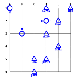
- Observe the grid map showing aircraft (marked with ID numbers) and waypoints (marked with NATO phonetic names like ALPHA, BRAVO)
- Read the question at the top of the screen carefully
- Questions may ask about heading, rotation, distance, or total distance between points
- Analyze the relative positions of the aircraft and waypoints
- Select the correct answer from the four options provided at the bottom of the screen
Skills You Develop
- Spatial reasoning and coordinate system interpretation
- Navigation concepts including heading, rotation, and distance calculation
- Visual analysis of grid-based positioning
- Mental rotation and directional understanding
- Flight planning and route optimization
- Quick decision making with multiple variables
Coaching Tips
- Remember that headings are measured in degrees clockwise from north (0°)
- When calculating rotations, determine the shortest turn direction (clockwise or counterclockwise)
- For distance questions, count the grid squares between points (diagonals count as one square)
- Pay attention to whether the question asks about a single leg or the total flight path
- Practice visualizing the flight path before selecting an answer
- Look for the aircraft's current heading as this affects the rotation calculation
Explore Other Training Modules
Discover more modules to enhance your FEAST preparation
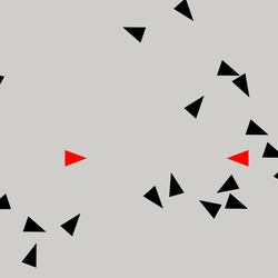
Detect Conflicts
A cognitive training game where you identify potential collisions between aircraft by detecting directional conflicts....
Learn More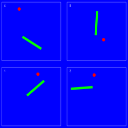
Divided Attention
A cognitive training game that tests your ability to monitor multiple areas simultaneously and respond quickly to events...
Learn More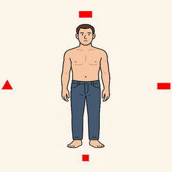
Distinguish Left and Right
A spatial reasoning game that tests your ability to identify the location of objects relative to a human figure shown fr...
Learn MoreReady to practice Estimate Distances and Directions?
Access the full simulation and track your performance inside the ATCO Europe SW training software.
Explore ATCO Europe SW Plans